Working in the newsroom is keeping me busy! Check out all of my stories on my contently page.
Mapping Twitter
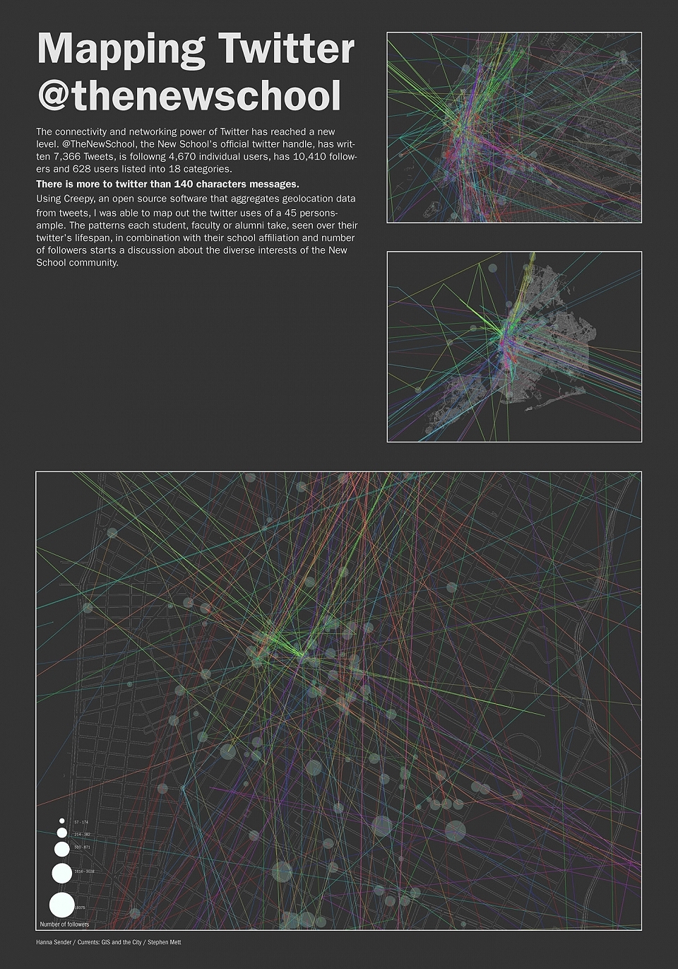

There is more to twitter than 140 characters.
Using creepy, an open source software that aggregates geolo- cation data from tweets, i was able to map out the twitter uses of a 45 person sample. the patterns each student, faculty or alumni take, seen over their twitter’s lifespan, in combination with their school affiliation and number of followers starts a discussion about the diverse interests and movements of the new school community. Created using ESRI arcGIS, the twitter api & open-source Creepy